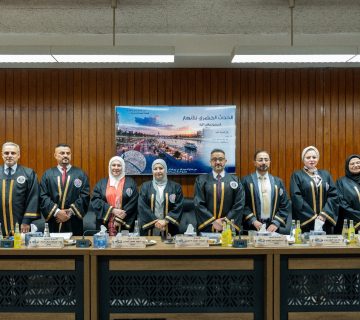
The public discussion of the master’s thesis by student Moamen Abdel Karim Hanoun, from the Department of Survey Engineering, was conducted. The thesis titled “Production of the fourth-dimension maps of the city of Baghdad using remote sensing techniques and geographic information systems” was discussed on Wednesday, 13/03/2024, in the Bayrouni Hall.
The examination committee included respected members:
- Prof. Dr. Mahmoud Diab Ahmed (Chair).
- Prof. Dr. Hatem Khalifa Brasim (Member).
- Assoc. Prof. Dr. Jassim Ahmed Ali (Member).
- Prof. Hussain Sabah Jaber (Member and Supervisor).
Department Media Team
Abstract
The fourth-dimension maps are an important methodology for managing natural resources and monitoring the ecosystem. Over the last several years, the Iraqi province of Baghdad has gone through significant changes. And the purpose of this research is to highlight these changes. Baghdad City is taken as a case study of (LULC) classes in a time frame of about 30 years, from 1993 to 2023 using multi-temporal sensors including Landsat 5, Landsat 7, and Landsat 8 images of Baghdad city. The Landsat satellite imageries have been collected from the (USGS) website. A supervised classification technique (SVM) was utilized for (LULC) classification of Landsat imagery of Baghdad city. The area is divided into five classes of land cover and land use namely: urban lands, vegetation, water bodies, soil, and wetlands.
The result of change detection from classification showed a decline in a class of water bodies from 2% to 1% during the study period 1993 to 2023. Change detection analysis shows from the classification that class urban areas increased continuously with time and accounted for 8% to 11% of study years 1993 and 2023, indicating the existence of the phenomenon of urban expansion. Soil land increased continuously and accounted for 15% to 35% of study years 1993 and 2023, respectively. Change detection analysis shows from the classification that class vegetation areas decreased continuously with time and accounted for 16% to 9% for the years of study in 1993 and 2023, respectively. Class wetland areas decreased continuously with time and accounted for 59% to 44% of study years 1993 and 2023, respectively.
The accuracy assessment of classification obtained is 89%, 91%, 92%, and 90% for the years 1993, 2003, 2013, and 2023, respectively. The kappa statistics were 87%, 89, 90%, and 88% for the years 1993, 2003, 2013, and 2023 respectively. After that, extract the change detection layer for each class to build the fourth-dimension maps for every year.